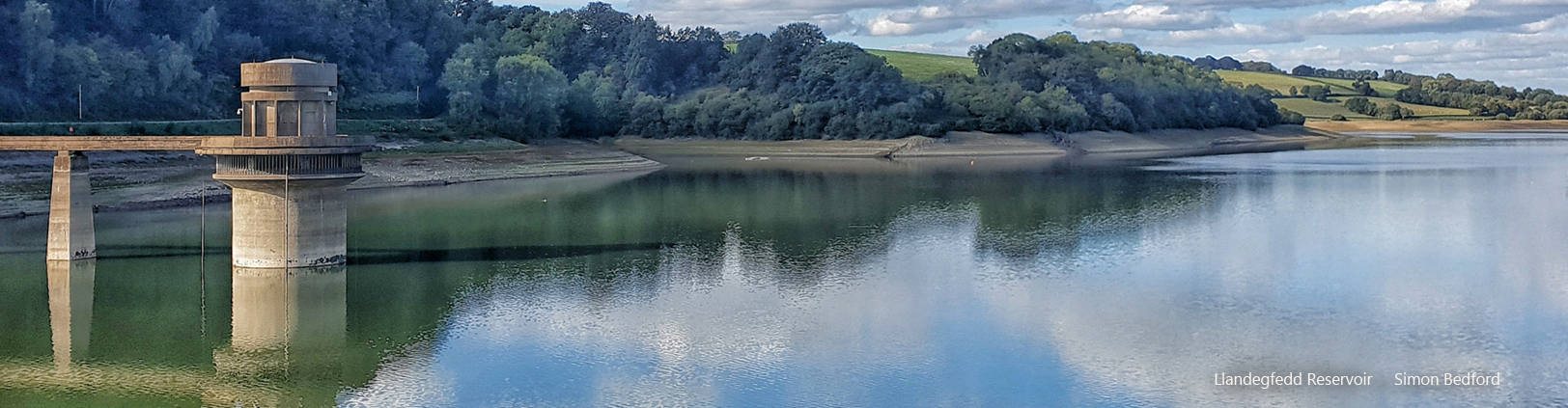
Llandegfedd Reservoir
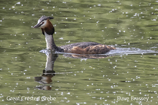
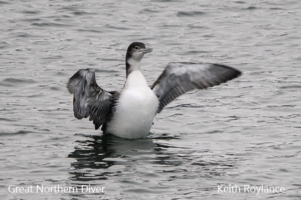
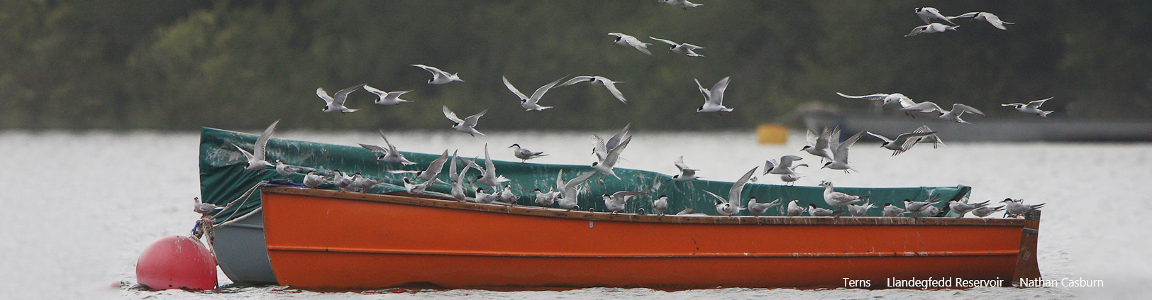
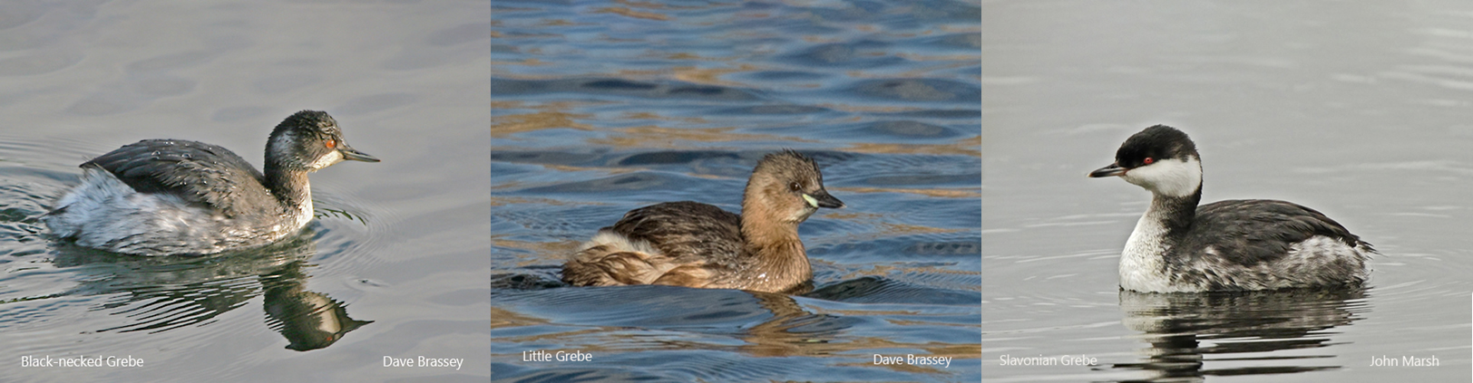
Llandegfedd Reservoir is the largest inland water body in Gwent, covering some 174 hectares. It lies near the village of Coed-y-Paen, about 3 miles east of Pontypool and consists mainly of open water with some reedbeds and willow carr at the northern end. This northern, shallower end is the best area for wintering wildfowl while rare grebes and divers may occasionally be found in the deeper water in the middle. The winter gull roost is impressive, in some years attracting rare species, whilst Osprey is regular in passage months.
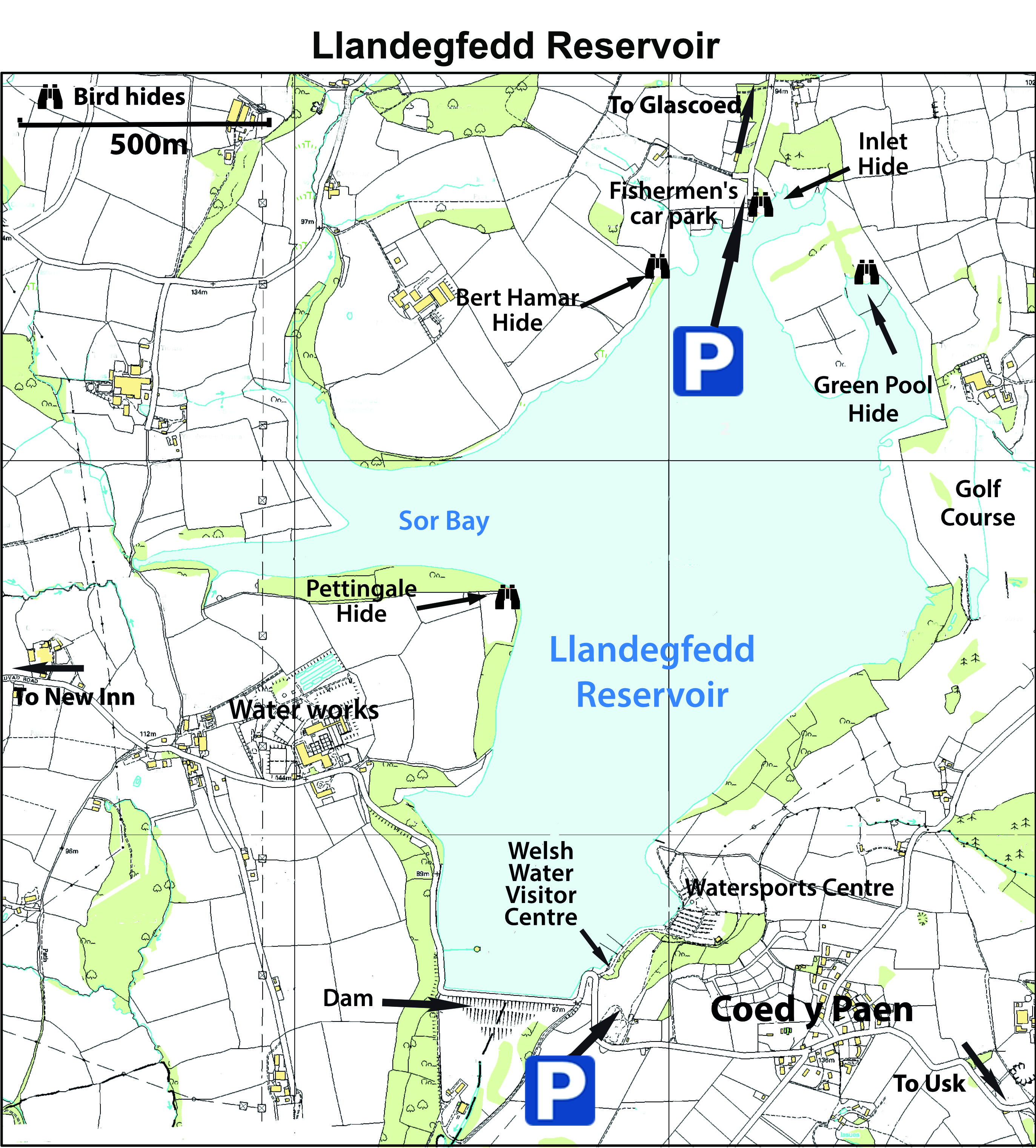
Views can be obtained from the fishermen’s car park at the northern end or from the dam at the southern end. Three hides are situated at the northern end and one near Sluvad Water Treatment Works south of Sor Bay – see map below.
The site is designated as an SSSI for wintering wildfowl and in order to avoid disturbance there is no access to the footpath on the east side between 1stOctober and 28thFebruary.
During the summer open season the gate to the northern fishermen’s car park will be open from 8.30am and locked at 5.30pm daily
Birdwatching permits
Permits are required if visiting between 1st October and 1st March. They are available to GOS members only, and are issued if requested along with the code to access the northern end during the winter months. Please leave this gate closed and locked if you use it, or this benefit may be withdrawn by the landlords. Access is only allowed between 9am-6pm (October) and 9am-4pm (November to end February). Dogs are not permitted in the restricted area.
Refreshments are available at the Welsh Water Visitor Centre (Tel: 01633 373401 for opening times).
Directions to Llandegfedd Reservoir
Please note there is no bus service.
Follow the A4042 Newport to Abergavenny road. South of Pontypool follow the signs from the roundabout to New Inn. After entering the village, turn right onto Jerusalem Lane, signposted Llandegfedd Reservoir.
To reach Pettingale Point, the dam and the Visitor Centre turn right 400m along Jerusalem Lane into Sluvad Road and continue for about one mile to the Water Treatment Works – park just past here for Pettingale hide. The dam is a further 800m along this road and the Visitor Centre is on the left just beyond the dam. If using Sat Nav please use NP4 0TA and once in Sluvad Road ignore instructions to turn right into a narrow lane; continue straight ahead.
To reach the fishermen’s car park on the northern shore drive to Jerusalem Lane (as above) but ignoring the right hand turn signposted Llandegfedd Reservoir, carry straight on for about 4kms. Turn right at a crossroads in Glascoed Village, into the road marked with a ‘No through road’ sign. The car park will be reached in about 500m.